Precision from Above,
Insight on the Ground
Welcome to Top Down Tasmania, your trusted partner in aerial intelligence. Based in the heart of Tasmania, we deliver high-precision drone services across Hobart, Launceston, Devonport, Burnie, and regional communities like Huonville, Scottsdale, and the Derwent Valley. Whether you’re managing a construction site in Glenorchy or mapping farmland in the Midlands, our drone solutions are designed to help you make faster, smarter, and more accurate decisions.
At Top Down Tasmania, we believe that better data leads to better decisions. Our mission is to empower Tasmanian businesses with cutting-edge drone mapping services that enhance compliance, improve efficiency, and unlock new opportunities for growth.
Licensed Drone Services in Tasmania
We are fully CASA-certified and insured, offering professional drone operations that comply with all Australian aviation regulations. Our licensed drone pilot services are available across Tasmania, from King Island to the East Coast, ensuring safe and reliable aerial data collection wherever your project is based.
Aerial Surveys & Photogrammetry
Our aerial survey services provide high-resolution 2D and 3D mapping, orthomosaic imagery, and digital elevation models (DEMs). These outputs are ideal for land development in areas like Sorell and Brighton, environmental monitoring in the Tarkine, and infrastructure planning across the state. Using advanced photogrammetry, we convert drone imagery into precise spatial data that supports engineering-grade analysis.
Construction Progress Reporting & Compliance
From major developments in Hobart’s CBD to regional infrastructure projects in Westbury or George Town, our drone-based construction reporting helps you:
- Track site progress over time
- Document compliance for regulatory bodies
- Identify issues early and reduce costly delays
- Minimise manual inspections and improve safety
Precision Agricultural Mapping & Surveying
In Tasmania’s fertile agricultural zones — from the Tamar Valley to the Central Highlands — we support farmers and agronomists with:
- NDVI crop health analysis
- Irrigation and drainage planning
- Pest and disease detection
- Yield forecasting and resource optimisation
Our drone mapping services help you make data-driven decisions that improve productivity and sustainability.
Learn how fellow Tasmanian Architecture, Engineering, and Construction (AEC) are benefiting from Drones to help streamline project timelines
Unlocking faster, safer, and more efficient project management with drone-powered solutions from Top Down Tasmania
The TopDownTas Difference
Why Drone Data Matters
Drone technology is revolutionising how Tasmanian businesses operate. With real-time aerial insights, you can:
- Make faster, more informed decisions
- Reduce operational costs and risks
- Improve safety by limiting on-site exposure
- Enhance communication with stakeholders using visual data
Whether you’re overseeing a vineyard in the Coal River Valley or managing a construction site in Kingston, drone data gives you the edge to act with confidence.
WORKING TOGETHER
Business-to-Business Partnerships
We proudly collaborate with organisations across Tasmania and Australia, including Construction and civil engineering firms; Agricultural producers; Environmental consultants and land managers; Local councils and infrastructure planners, and beyond.
Our partnerships are built on trust, transparency, and a shared commitment to innovation. We offer flexible service models, white-label solutions, and custom data integrations to fit your workflow.
Meet The Founder
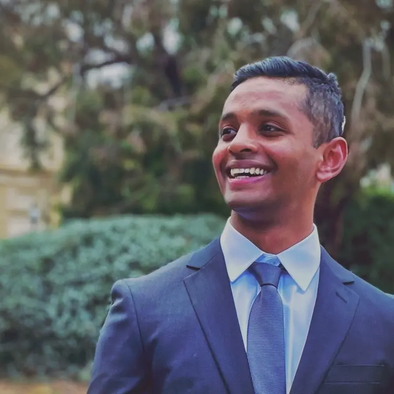
Rohit Augustine
Top Down Tasmania was founded by Rohit Augustine, a passionate technologist and fully licensed drone pilot. With a background in business management and logistics, Rohit brings a rare combination of strategic insight and technical expertise to every project.
His skills in Geographic Information Systems (GIS), spatial analysis, and drone operations make him a powerful problem-solver. Whether it’s mapping a remote paddock in Cressy or inspecting a multi-storey development in Sandy Bay, Rohit approaches each challenge with precision, creativity, and a deep respect for the client’s goals.
Rohit’s passion for technology and innovation is the driving force behind Top Down Tasmania. His vision is clear: to help Tasmanian businesses unlock the full potential of aerial intelligence.


